My Favorite Links
- WebCams (BC)
- TWP TW Paterson
- Kinsol Webcam
- Oregon Highway Cams
- WJI's YouTube VIDEOS
- CPO MESS
- Bigwave Dave Cams
- Flickr Photos
- History Cedar Hill Golf Course
Archives ON
my walking weBlog
Friday, October 25, 2024
DJI3 Osmo at E&N Okotoks Powerline Xing
 We walked 4½km along the E&N tracks from Shawnigan Lake Rd. Xing to Okotoks Powerline Xing.
Every road off Okotoks roads are marked as PRIVATE as are all E&N road Xings. Strange.
When it comes down to it the E&N railway itself is PRIVATE.
Soon enough the E&N RoW will be gone, but we're going to keep on enjoying it as long as possible.
Tuesday, October 01, 2024
Finding E&N Malahat Level Xing
 E&N Railway at Malahat BC
Tuesday, October 1st I drove the 27km (16miles) from Victoria BC to Malahat, BC.
E&N Railway at Malahat BC
Tuesday, October 1st I drove the 27km (16miles) from Victoria BC to Malahat, BC.
The purpose being to find a level access to the E&N Railway near this location.
After driving through Cedar Springs Ranch campground I ended up at Malahat Mountain Meadows Campground.
The campers here told me how to get to the tracks using the nearby trail.
This access had too much gain for my purposes so after walking the tracks southbound for ten minutes a level xing appeared.
This level xing connects from Cedar Spring Ranch campground (the place I just drove through).
We remember this campground from the 60s and is where our kids learned to swim in the outdoor pool.
Tuesday, September 24, 2024
Walked 4km Roundtrip along E&N Railway
 Goldstream Suspension Bridge via E&N Rail Grade
Tuesday our son and I walked 2km from Humpback Rd along the E&N railway to Goldsream Suspension Bridge
Goldstream Suspension Bridge via E&N Rail Grade
Tuesday our son and I walked 2km from Humpback Rd along the E&N railway to Goldsream Suspension Bridge
The plan was to walk the 5km to Cisco Bridge over Niagara Canyon but that didn't happen.
The CRD aka Capital Regional District Victoria Water Supply has the tracks gated and locked at their facility.
We walked up and viewed the suspension bridge but didn't walk down the 150m grade.
On the way in our son got stung no less than three times by bees. The bees had built a nest on one of the rotted-out railway ties.
It was a great day to be outdoors and we met others along this route. Addendum We enjoyed beautiful weather this morning by hiking 4km roundtrip along the Esquimalt and Nanaimo railway tracks. These tracks have been abandoned to train service since May 10, 2011 but are frequented often by locals and hikers. This section provides a shorter and flatter access to the Goldstream suspension Bridge than does the Great Trail. Our walk stated at Humpback Road where it crosses the railway tracks. The Great Trail (formerly known as the Trans Canada Trail) is one of the world's longest networks of multi-use recreational trails. Once fully connected, it will stretch nearly 24,000 km from the Atlantic to the Pacific to the Arctic oceans, through every province and territory, linking Canadians in nearly 1,000 communities.
Our son was good enough to join me on a hike with which he was not familiar. Shortley after departing our trail-head he may have been having second thoughts after being stung by no less than three bees! Being a tough lad he carried on without comment. The suspension bridge is located where the Victoria Water District has a treatment facility so there are many gates and signs reminding users of restricted areas. The down side for users is they also block access along the rail grade. The VIA Rail Dayliner could run through here but appearenttey walkers cannot. The Capital Regional District has it locked down pretty good.
Labels: djineo, e&n, goldstream, walked
Thursday, October 05, 2023
Disrupted Ride by Dislocated Finger
 My Thursday morning bicycle ride was interrupted by a minor mishap.
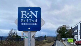
It happend while walking — not riding — my bicycle around a sharp corner to get back onto the E&N Rail Trail at Admirals Road.
Stupid me, remained seated on my bike while I 'walked' it around a sharp corner on a paved trail.
What I did not notice was the trail surface was lower on my righthand side and when I put my right foot down there was nothing there.
The resulting nosedive put my left hand index finger up against a brick wall with the full force of my body weight behind it.
The end of my finger stopped while the rest kept moving one finger bone beneath the other. Not good.
Said finger also became lacerated which required some stitches. Looks good now.
Sunday, October 16, 2022
54km Cycling Loop with Amos

Sunday our grandson (24yrs) cycled with me on a long, loop bike ride from hi home near Cook Village.
I cycled 13km from home to his place then we rode a 26km loop out to Atkins Station in View Royal.
From there I rode another 15km along the Victoria Seaside Route to home through the Uplands District.
Monday, September 26, 2022
43km Loop GGT to E&N Rail Trail + downtown
 E&N Rail Trail Biking Kimta Railyards 3-minutes #507
Monday morning I cycled a 43km loop from home starting by joining the Galloping Goose Trail at McKenzie Avenue.
E&N Rail Trail Biking Kimta Railyards 3-minutes #507
Monday morning I cycled a 43km loop from home starting by joining the Galloping Goose Trail at McKenzie Avenue.
After riding The Goose to downtown Victoria BC it was up Fort St. to the Vancouver Street Bike Lane to Beacon Hill Park.
Once through the park it was along Dallas Rd., past the cruiseship terminal to downtown again and over the Johnson Street Bridge.
Using the Esquimalt Rd. overpass we were northwest bound on the E&N Rail Trail to Atkins Station in View Royal.
That's another 13km back home so on a beautiful morning there's nowhere else to be.
I video recorded the E&N railway, single-track section by Kimta Rd. with my GoPro and posted the 3-minute video.
E&N Rail Trail Biking Kimta Railyards 3-minutes #507
Saturday, June 12, 2021
Cycle 53km Loop E&N out GGT in
 Saturday morning I cycled 53km loop outbound along E&N Rail Trail and inbound along Galloping Goose Trail. A wonderful three-hour adventure starting at 7:30a.m. under overcast skies.
Started from home and cycled Lochside Trail/Galloping Goose Trail, 10km to E&N Rail Trail overpass at Esquimalt Rd (Johnson Street Bridge).
HIGHLIGHT The new, one-kilometre trail section between Atkins Rd and Savory School is now paved.
Then another 14km to trail's end at Jacklin Road in Langford. Across Jacklin is Dunford Ave. and down the hill along Henry Eng Plc. This industrial route connects to Fieldview Terrace which is a name-change along Leigh Road.
Once northwest bound along Langford Parkway, its down the dedicated cycling route beside Westhills Drive, past the YMCA and up to the end of the parking lot.
Caveat to above: My first-choice-of-route would be the Ed Nixon Trail beside Langford Lake but it's blocked off at the S.E., wooden boardwalk. Who knows when that will be open; no one is working on it.
There is a single-track connection from here to West Shore Parkway where the E&N Railway crosses. There are various routes through to Humpback Rd. but I chose the Upper Trail which starts underneath The Wall. From here it's one-kilometre through the rough, single-track to Humpback Rd., Great Trail connector.
Upper Powerline Langford Trail GoPro #460
Langford Humpback Trail VIDEO
N.B. 230m diversion at Westwind (from Mapsend, Viewranger GPS track) 51 minutes duration / start at crossover overpass is 10km from home along PaloAlto/Mortimer/Mckenzie/Borden/GGT. Ends Jacklin Rd at Station Rd to Dunford Ave. N.B. Humpback Rd. is 28.4km from Home. (24.6 inbound to home from Humpback Rd trailhead) 9:17a.m. at Humpback gate. 1:47:00 outbound / 1:19:00 direct inbound Humpback/Irwin/Meridian/WestShore past Belmont school/ Hull's Trail/ Kelly to GGT/ Borden/McKenzie/ McClung Library/Mortimer/Palo Alto.
Saturday, June 05, 2021
46km Biking to Langford
 Saturday morning I cycled 46km roundtrip from home to Humpback Road and back. I rode the Galloping Goose Trail outbound to Millstream connector then the (All-new section) E&N Rail Trail to Jacklin Rd. at Dunford where the paved trail ends. Once down Dunford Ave. and past Langford Lake, I took the usual, single-track route from the YMCA parking lot to Humpback Rd. The same route back got me home in three-hours total, trip time.
Of late my main interest in Langford — and specifically its trail network — is to find out what the citu of Langford's plans regarding the latest, cycling additions along Humpback Rd. and its connection to the Great Trail on Vancouver Island, aka, Sooke Wilderness Trail.
The new Montego Drive connector may be one option in the works. Presumably, this would be accessed from Burlington Crescent near Kettle Creek Station housing development. This connection would inlcude Burlington, Montego and Lakehurst between Humpback Rd. to the west.
Another option, — and one many support — is to develope the already-established Upper Power Line Trail between West Shore Parkway and Humpback Rd. It is well established and well used already.
To this end, may I suggest viewing a biking video through the one-kilometre (1km) section of active trail.
N.B. Trail users could be encoureage to use the single-track trail between the YMCA and the Upper Power Line Trail.
Disclaimer All-of-the-above becomes redundant once the E&N Rail Trail is completed to Humpback Road.
Upper Powerline Langford Trail GoPro #460
Sunday, May 23, 2021
Cycled 48km Roundtrip to Langford

Sunday morning I took a three hour, 48km bike ride out to Langford and back.
Cycled the Galloping Goose outbound and the E&N Rail Trail inbound.
The ride was one of my best ever. We (me and God), observed the new E&N Rail Trail construction between Savory School and Atkins Road.
What a great job they're doing over this one-kilometre (1km) section. Why, it even sports a concrete tunnel under the tracks!
The destination for this ride was the E&N railway above Montego Drive in Langford.
We cycled down the rough path from Kettle Creek Station and came out on Burlington Crescent after traversing the construction area.
Monday, May 10, 2021
Cowichan Chronicles A Story To Be Told
From TWP's Cowichan Chronicles “Oops! A wreck on the CNR (Trans Canada Trail) about Mile 60. This was a fatal head-on collision; I have two coupling pins—one from each train as they’re different sizes.” A Story to Be Told is a book written by Robert I. Dougan and is the definitive record of the September 15, 1900, accident involving a headon collision between two trains on the E&N tracks near Ladysmith, BC.
Nathan Paul Dougan, was the telegrapher/station agent at the new town of Ladysmith in September, 1900 at the time of the train wreck on the E&N two miles north of town which killed 4 people.
Nathan Dougan (father of Robert I. Dougan) was blamed for the accident and charged with manslaughter for which he was sentenced to nine (9) months imprisonment. These photos are from a hike guided by T.W. Paterson and his associate, Doug McLeod, to find where and what remains from that accident.
Ladysmith Wreck Trailhead GPS Coordinates: 49°0' 41.55"N 123°50' 50.78"W N.B. Other than using the GPS coordinates, finding this sawed-of windfall (left in frame) is the only indicator to find where the access to the wreck is located in the thick underbrush. From March 17 2021 photos From Flickr March 18 2021 YouTube VIDEO Link A Story to Be Told is a book written by Robert I. Dougan and is the definitive record of the September 15, 1900, accident involving a headon collision between two trains on the E&N tracks near Ladysmith, BC.
Nathan Paul Dougan, was the telegrapher/station agent at the new town of Ladysmith, BC in September, 1900 at the time of the train wreck on the E&N two miles north of town which killed 4 people.
Nathan Dougan (father of Robert I. Dougan) was blamed for the accident and charged with manslaughter for which he was sentenced to nine (9) months imprisonment. These photos are from a hike guided by T.W. Paterson and his associate, Doug McLeod, to find where and what remains from that accident. Ladysmith Wreck
Trailhead GPS Coordinates: 49°0' 41.55"N 123°50' 50.78"W N.B. Other than using the GPS coordinates, finding this sawed-off windfall (left in frame) is the only indicator to find where the access to the wreck is located in the thick underbrush.
Ladysmith Train Wreck Site GPS: N49°00.719', W123°50.841'
Friday, November 20, 2020
TC Motors GGT/E&N E-bike Circle Loop
 Friday I cycled 30km roundtrip from home along the Galloping Goose Trail to TC Motors.
My route inbound (that means back home) was over Selkirk Trestle/ Banfield Park/ Pine St./ Hereward Park/ E&N Rail Trail to Helmcken Rd.
Down the ramp to the roundabout then into View Royal Park and onto Maclennan Trail at the 8km Marker of the Galloping Goose Trail.
Silly me lit out with a less-than-fully-charged battery and had to walk the last 2km to home. Some guys never learn.
Biking Galloping Goose Trail to E&N Rail Trail
Maclennan Trail connector between E&N Rail Trail and Galloping Goose Trail VIDEO
Wednesday, March 18, 2020
Cycled 34km loop E&N and GGT
 Wednesday morning I cycled a 34km loop from home around the Great Circle Route formed by the connection between the E&N Rail Trail and the Galloping Goose Trail in the Greater Victoria Area.
On a bright, sunny day at a balmy 11°C. (52°F.)
Most of the trail beside the McKenzie Interchange Project is complete with paving and the wall.
Sunday, August 25, 2019
Cycled the Great Circle Route from Home and back

That's the moniker I've given to the 19km loop formed by joining the Galloping Goose Trail and the E&N Rail Trail.
I've cycled the loop several times but today was the first time done from home -- hence the greater distance.
My plan A was to ride out to the Goldstream Suspension Bridge but upon further consideration decided to do it on a fully-charged battery.
Seems it was a prudent move as the battery was pretty low when arriving back home.
Friday, July 12, 2019
Cycled Del Sol 34km Loop

The lad wanted my Yuneec CGO3 Steadygrip video camera and I wanted to cycle this loop from home so it worked out good for both of us.
The new ebike gave me a good work out but I wasn't exhausted when I arrived back home. That's nice for a change.
Bentley and my daughter say all the repairs and upgrades to their beautiful home are complete.
We hope the Steadygrip works better for Bentley than it has for me.
Monday, April 01, 2019
Great Circle Ride 19km Loop
 Monday morning we cycled 19km along the loop formed by the Galloping Goose Trail and the E&N Rail Trail
This section of these paved trails traverse multiple jurisdictions on southern Vancouver Island: Esquimalt; Langford; Victoria and View Royal.
This outing brought an end to my birthday celebrations which started last Thursday. Every year on my birthday for the past decade our son takes me on a cycling excursion -- lunch included.
Today's ride took less than 1½hrs so the old boy can still ride. I've done this particular 19km loop every year over the past five years but today seemed more enervating than past ones. It's only my second ride this season so I'll have to shape up, or get a pedalec bike. LOL
It was a great ride and C. is very generous with his time and gifts. Thanks, pal.
Friday, August 31, 2018
E-bike Langford Victoria 35km Loop

Our son-in-law & family live near the E&N Rail Trail in View Royal. Ben often walks the trail over to the gym in Colwood and this day our paths crossed. Hence, the photo with me and my ride.
Here's a VIDEO Cycling Across The Johnson Street Bridge (The Bascule)
This GoPro video is a bit shakier than usual as my handle-bar mount took quite a beating while attached to the rental, e-bike. The Norco e-bike had no front shocks and the tires were as hard as steel. It seems even a grain of sand registers in the video. Sorry about that. Next time I'll go back to the tried-and-true method of having the GoPro on the chest-mount.
Friday, May 25, 2018
Cycled E&N Thru Langford

Atkins Station parking was completely full of park&ride vehicles so there was no room for those for whom the parking lot was built -- trail users.
Therefore, I drove onward to Atkins Road parking near Millstream Bridge which provides access to both the Galloping Goose Trail (GGT) and the E&N Rail Trail (E&NRT).
The latter is not as well defined as the former but the E&NRT has a dedicated section to begin with northbound but soon runs out so one has to ride on the narrow, winding road with motor vehicles. It's been like this for yeas now and it is unlikely it will ever be improved for cyclists.
If one can successfully maneuver themselves and bicycle for another kilometre nothbound along Arkins road there are designated (not to be confused with dedicated) bike lanes.
At this location there is another option for those not in hurry: Cross over the footbridge which crosses over the E&N Railway tracks into Savory Elementary School. This is where one can again ride on a dedicated trail section of the E&N Rail Trail.
As well done as the improvements are to this section of the E&NRT, traversing it through Langford could become an exercise in futility. The interminable waits at the traffic lights at the numerous road crossings makes one wish they had chosen to cycled elsewhere. There's a lengthy wait at Goldstream Ave. crossing and then after tracking the Station road section one comes to Peatt Road crossing. Here one has to use several pedestrian crosswalks to finally arrive at the trailhead on the western side. After cycling for another 450 metres or so, one arrives at Jacklin Road crossing. Jacklin road appears to be the end of the E&NRT westbound. If it continues it was not apparent to me so after cycling along Dunford Road for a while I turned around and cycled back to my vehicle.
BTW, I did enjoy my morning cycling and refreshing my memory why it's been almost a decade since I cycled here last. LOL
Wednesday, October 04, 2017
E&N Rail Trail turned Achaeological Dig
Labels: e&n, railtrails, walked
Wednesday, July 26, 2017
Esquimalt Indian Reservation
 I learnt something today about the new road being completed through the Esquimalt Nation Reservation Lands. After talking with a couple of Indian lads they told me that Thomas Road will be closed at its connection to Admirals Road and all future movements -- inbound and outbound -- will be via the new connector to Hallowell Road. Presumably, this will impove the safety of all concerned by directing everyone to the traffic light control at the Hallowell/Admirals Road intersection.
Again, presumably, this will only affect those seeking access and egress from the Esquimalt Nation Reservation Lands. This is where some band members live and have their headquarters and recreational facilities and other structures situated along the only two roads contained therein: Modeste Rd and Kosapsum Crescent. Access to both roads has for years been posted as private property and no trespassing signs. Apparently, to keep the white man out -- or woman, if it comes to that.
Seem odd inasmuch as the Indians have free access to all other roads built by the Europeans. All the construction workers on the new road are of European descent and all machinery and supplies are provided by Europeans. Strange, circumstantial times in which we live.
N.B. Now, railway crossing-gates will have to be installed at Hallowell Rd. and Kosapsum Cres. E&N Xing.
Saturday, July 22, 2017
West Hills To Humpack Rd on Powerline Trail
 Saturday morning I walked 3½km roundtrip from Westhills in Langford along the powerline trail to Humpback Road and return.
Someday these two communities will be connected by road so those visiting or living in the growing community of Goldstream won't have to use Hwy-1 all the time.
The powerline trail and the E&N tracks were quite busy with local pedestrians out walking the dog or commuting to shops in Langford.
This connector and the proposed roads will be a welcome asset to those living in Kettle Creek Station in Langford, BC and Goldstream housing and mobiles.
![]()